white lettering on orange background northshorevisitor.com com logo
high falls baptism river tettegouche


Tettegouche State Park Trails

mile 58.5

Amenities: picnic areas, visitor center
Length: 23 miles
Difficulty: some easy, more moderate to most difficult due to steps and rise in elevation
Trailheads: at Visitor Center, at Campground & on Lax Lake Road

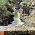
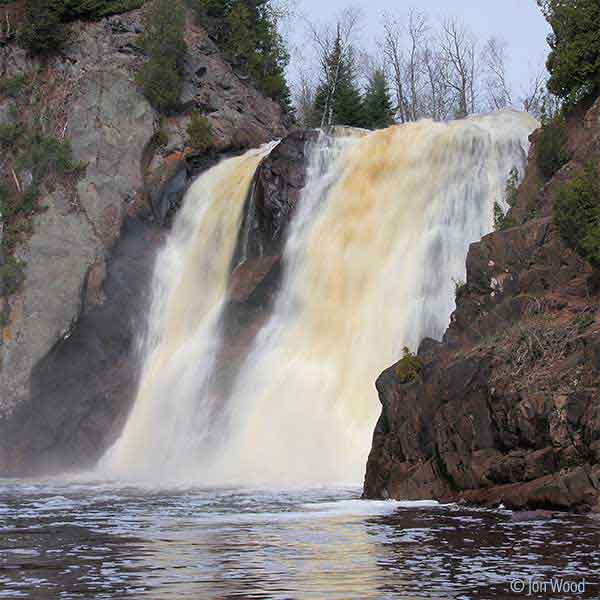
Great variety of trails; meander easier trails near the visitor center, or drive in to the park and spend a day [or more] exploring; follow the Superior Hiking Trail west from the campground for overlooks, then head north and traverse around Mic Mac and Nipisquit lakes before returning. See below for details on hiking to the waterfalls and from the Lax Lake Road trailhead.

**note the trail from the visitor center area to the falls has a lot of steps, so not the best for those with knee issues; instead, consider parking at the Superior Hiking Trail trailhead on Hwy 1 and hiking in [still some steps]

The High Falls bridge is CLOSED indefinitely due to flood damage. Superior Hiking Trail thru-hikers will have to detour down toward the park office to cross the river on the park road bridge. Note - you can still hike to the High Falls from both sides; you just can't cross the river. The Cascade Falls Trail is also CLOSED indefinitely due to flood damage on a bridge. There is no detour.


Check out these North Shore Favorites

sun over gunflint trail lake at golden eagle cabins
wintry ski in ski out townhomes at caribou highlands lodge at lutsen mountains
snowy east bay suites on lake superior in grand marais from drone perspective
upcoming events
Art Along the Lake: Fall Studio Tour
22 Sep 23
Grand Marais
Bird Banding
28 Sep 23
Schroeder
MUSE 12x12 Exhibit
28 Sep 23
Grand Marais
Thursday Afternoon Art
28 Sep 23
Grand Marais
Grand Marais Farmer's Market
28 Sep 23
Grand Marais
sparkling wintry lake superior and ice sheets stacked on north shore

Get North Shore travel tips delivered to your inbox