North shore waterfalls
This territory is striped with rivers that make fabulous leaps off fir-lined ridges. By virtue of motion, rivers change every moment and every season. In 1930 Congress prohibited the construction of dams in St. Louis, Lake and Cook counties ensuring these rivers remain in their natural state. The average gradient of the rivers is 50-100 feet per mile with waterfalls and rapids sections dropping up to 300 feet per mile.
Waterfalls near Duluth tend to be showy. With no headwaters [lakes or other streams that are the water source] , the rivers swell and pound during spring run-off and heavy rains and run low during dry times. They can carry up to four times as much water as those with headwaters. From the Manitou River midway between Duluth and Canada, the rivers have lakes feeding into them and a more stable flow. But it’s a close call to the best performance during the run-off.
Check out the falls in the Beaver River, in Beaver Bay [MM 51.3].
what is the highest waterfall on the North Shore?
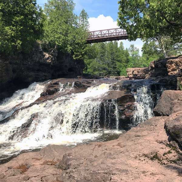
The 120-foot High Falls at Grand Portage State Park is the highest [picture aboved]. It is located on the Pigeon River, part of the international boundary with Canada. The highest falls entirely within Minnesota is the 70-foot High Falls of the Baptism River and is part of Tettegouche State Park.
Which north shore waterfalls to see
We list 17 North Shore waterfalls that enter Lake Superior. Each is worth a visit, but the two most popular are Gooseberry Falls and Devil’s Kettle.
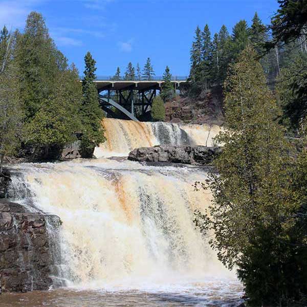
Gooseberry Falls is actually four waterfalls. All located at Gooseberry Fall State Park, northeast of Two Harbors. They are an easy walk from the visitor center.
Devil’s Kettle is the mysterious split in the Brule River where half the water disappears into a cauldron. No one know where it goes! Devil’s Kettle is located at Judge Magney State Park, northeast of Grand Marais.
North Shore Waterfall Maps
North Shore Waterfall Tours
These categories will help you choose.
Spring Beauties
While they are all spring beauties, these waterfalls ONLY rush and roar in the spring.
All Summer Long
With headwaters feeding these rivers, you will find running waterfalls all summer long.
Drive-bys and Short Hikes
Those you can literally drive by or walk to very easily in under a half-mile total.
Big Hike, Big Reward
If you’re willing to take a hike that usually involves some sort of climbing on the way up and descending on the way back, your reward are these waterfalls. Hikes are 1-mile and longer.
High Falls
These waterfalls range from 35 to 120-feet tall.
north shore waterfalls
Select your attributes to find the right waterfall option. After selecting, close this box and your results will appear.
Waterfall type
near
search tips
On mobile, click on the location icon.
On desktop, type in your location.
To find Gunflint Trail shopping, type in ‘Poplar Lake West Cook, MN.’
Lester Park offers playgrounds, green space, waterfalls, hiking, biking, plus fat bike trails and cross country-ski trails. Playground and the trailhead are located near the parking area of the Lester River Road. See the Amity Falls under hiking and waterfalls for another trailhead.
Start your waterfall tour with a look-see over the Superior Street bridge at the Lester River Falls or park in the lot on the east side of the river, half a block north, and walk the creek-side trail. The northeast trail is a woodland walk with a series of small falls. Best seen during spring run-off.
Walks and hikes range from 0.2 to 9+ miles. Bike Trails include the easy/beginner-friendly 3.7 mile Lester River Trail and the moderate 3.9 mile East & West Amity Trail. Note the Lester River Trail connects to the 43+ mile Duluth Traverse Trail which runs east-to-west across Duluth.
Amenities: restrooms, water, picnic tables, grills and playground at trailhead
Length: 9+ miles
Difficulty: easy
Amity Creek runs through Lester Park and you have two options to reach the narrow, picturesque Amity Falls. For a longer hike begin at the Lester Park parking area and hike a 1.5-miles to the northwest where you will come upon the base of the falls, my favorite view. Hike the short steep hill to cross the foot bridge and see the upper river view. To make this a short easy hike, drive north on Occidental Boulevard to the parking area and follow the path to the footbridge. It’s worth it to walk down the hill – and back up – to see the falls from below.
Amenities: restrooms, water, picnic tables, grills and playground at trailhead
Length: from 0.5- to 3+ miles
Difficulty: easy
It’s a 4-for-1 waterfall stop at Gooseberry Falls State Park! Paved, accessible trails lead 1/10 mile from the visitor center to the most photographed of the falls, the expansive Middle Falls. The paved trails continue north under Highway 61 to a lovely view of the scenic Upper Falls. This wonderful little loop is a half mile total from the visitor center and back. The Riverview Trail heads south from the Middle Falls past the Lower Falls to the mouth of the Gooseberry River and Lake Superior. See the Fifth Falls entry for details on that hike. While quite spectacular during spring runoff, this quick-stop leg-stretcher is a must do on your North Shore visit.
Amenities: Visitor center has restrooms, and during open hours a gift shop and exhibits
Length: 0.3-1.4 miles
Difficulty: easy, paved, accessible to Middle Falls
While the fifth falls is the smallest waterfall at Gooseberry Falls State Park, it is a nice walk through the woods through the woods. The Fifth Falls Trail runs north along the east side of the meandering river slowly climbing to the base of the falls. The path leads up across the river to a nice scenic overlook before returning south, and downhill, along the west side of the river in a mile loop. In the winter, a there-and-back cross-country ski trail leads to the same falls and scenic overlook.
Amenities: Visitor center has restrooms, and during open hours a gift shop and exhibits
Length: 2+ miles
Difficulty: easy, partially paved
The Split Rock River waterfalls feels like you’re really out in the woods, but you can be there and back in a half hour. The hike starts on the west side of the river climbing a half-mile through birch forests to the falls tumbling 20 feet over grey rock into a rock-edged pool. You can turn around here [1+ mile total] or hike another three-quarter mile to an impressive red rock [rhyolite] gorge with 50-foot cliffs and twin red pillars. This is another point where you can turn around [2.6 mile total]. If you choose to continue you will see a few more waterfalls over the next 3/4 of a mile. At that point you have to cross the river [in the water] and pick up the high east trail which showcases wide open Lake Superior views.
Highlights: now two hikes, one up each side of the river, with the option of crossing during low water [most of the summer – but can flow after rains] to make it a loop; the west side trail runs above the river past rock cliffs, and on the east side you get river valley views and Lake Superior overlooks
Amenities: at state park 1 mile away
Length: 5 miles round-trip
Difficulty: moderate to more difficult [some steep grades]
Surface: hard pack with roots and rocks
Climb the wooden steps and hike above the river to view the cascades near the river mouth then continue another 1/2 mile to see the Stair Step Falls. Can only be seen before the trees leaf out and is best in spring when the river rushes. Easy to follow trail from parking at the Ray Berglund Wayside and Recreation Site.
Length: 1.15 miles
Difficulty: easy

upcoming events


