white lettering on orange background northshorevisitor.com com logo
Search
Close this search box.
Search
Close this search box.
snow on pines at judge magney state park north shore

Judge C.R. Magney State Park

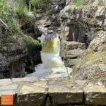
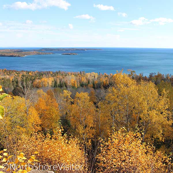
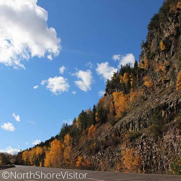
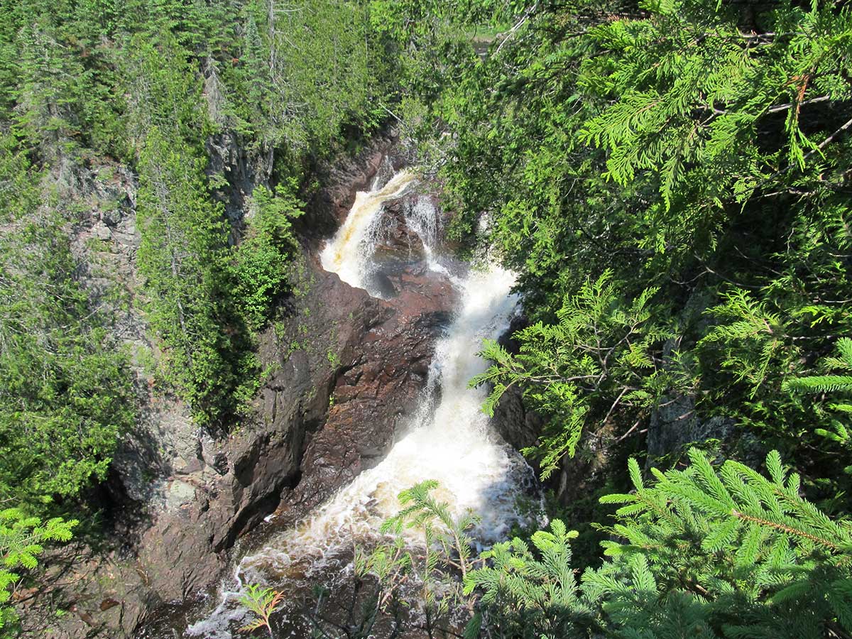
judge c.r. magney state park, AKA judge magney state park, is similar to Manitou Park’s essence, but more accommodating to tent and trailer campers. While many boast of the Brule’s fishing, the park’s real claim to fame is the Devil’s Kettle. Rumored to have no bottom, this cauldron perpetually drinks down half the river’s water flow. The riverside hike treats you to excellent vantage points of the Lower and Upper Falls and the Devil’s Kettle.

The park name honors Judge Magney, an advocate of state parks, who helped establish 11 state parks and waysides on the North Shore. Take a moment and tip your hat to this visionary.

Play Video about Devils Kettle Waterfall Magney State Park

Devil’s Kettle on the left – where half of the Brule River disappears down a cauldron.

Park Overview

mile 123.8


Open 9am-4pm in the summer; call first in the winter. The office is located on the road into campground on west side of Brule River; sells firewood and park permits. Find picnic areas on the east side of the river .1 mile walk in, and one adjacent to the day-use parking area on the west side of the river.


4051 East Highway 61 | Grand Marais
218-387-6300

Judge Magney Area Camping

wintry ski in ski out townhomes at caribou highlands lodge at lutsen mountains

Spring, Summer, Fall Activities

mile 124.0

Judge Magney State Park’s claim to fame is the Devil’s Kettle. Rumored to have no bottom this watery cauldron perpetually turns and froths. The hike up treats you to excellent vantage points of the Lower Falls before leading to where the river course splits. About half of the river’s water flow runs over the grand Upper Falls while the other disappears into the Devil’s Kettle. The river rushes in the spring, but to get the best perspective of the Devil’s kettle, plan a summer or autumn visit. Plan on 100+ stairs each way; about 2 ¼ miles total.

mile 150.3

On the US/Canadian border, the Pigeon River drops 950 feet ending with the 120-foot drop High Falls, the highest you will find on the North Shore. This lower reach is particularly rugged until a short distance after the falls, where the river widens. An easy half-mile trail in Grand Portage State Park leads to the High Falls. The trail ends with two great viewing decks where you can feel the spray of the falls!

mile 128.7

The former site of the lookout tower overlooks sugar maples, quaking aspens and conifers, making it a good drive and hike all fall color season long. This is a good wildlife viewing spot.

From mile marker 128.7 on Hwy 61 in Hovland, turn north on Arrowhead Trail for 3.7 miles, then park on the side of the road [leaving room for other traffic] and hike 1.5 miles west on the Superior Hiking Trail. Return for a 3-mile overall hike.

**Note: the Superior Hiking Trail Parking trailhead is 3.3 miles north on Arrowhead Trail; hiking from here increases the hike length to about 4 miles.

The lookout tower itself was taken down in 2017, however the drive and the hike are still quite pretty.
mile 146.6

The Mount Josephine Wayside Rest has a spectacular overlook with views of the Susie Islands below in Lake Superior and Isle Royale in the distance. Isle Royale National Park is part of Michigan. The area is open April through October, has picnic tables and outhouses, and is located on the lake side of Highway 61.

mile 144.8 + 0.9 miles

Learn Aniishinaabe art, culture and history. Directions: from Highway 61 MM 143.3 turn right onto Mile Creek Rd, and at the first cross street, turn left and continue 0.7 miles on Mile Creek Rd.


170 Mile Creek Road | Grand Portage
218-475-0123

Winter Activities

mile 118.7

This is such a great snowshoe hike! You can walk up the frozen river which gives you the opportunity to be in the river gorge looking up the canyon walls, and come right up to the waterfalls and cascades. The Superior Hiking Trail runs to the east of the river if that’s your preference. Or you can step off the river about a third-mile in and return on the hiking trail. Be sure to look for tracks in the snow – hares, voles and even an otter slide, pictured here.

mile 123.8

The super popular Devil’s Kettle Trail runs atop cliffs running riverside above the Brule River and ends with a loooong staircase down to the base of the Lower Falls before a short climb to view the split in the river. The eastern flow tumbles over the High Falls while the western arm drops into the Devil’s Kettle, final destination unknown.

From the parking area, the easy flat Timberdoodle Trail meanders through the woods for a mile while the 2+-mile Gauthier Creek rises over hills and takes you into this picturesque waterway. Perfect if you’re looking for somewhere to snowshoe that is infrequented.

Length: 2.25 miles Devil’s Kettle; 1-mile Timberdoodle; 2+ miles Gauthier Creek
Difficulty: easy to moderate; Devil’s Kettle includes about 200 stairs

mile 143.9

Miles of scenic trails traverse the hilly terrain rising north from Lake Superior. The two main trail centers are located at Grand Portage Lodge & Casino and at Mineral Center (from Hwy 61, drive north on Mineral Center Rd / Co. Rd. 17 for about 5 miles to the trail center. Trails criss-cross the back country with one trail leading to Ryden’s Border Store & Gas Station on the US / Canada border.

Length: 100+ miles

mile 150.8

It’s all about hiking to the 120-foot High Falls, but leave time for the exhibits, gift shop, and interpretive signs in and around the Visitor Center, where you can learn about the culture and traditions of the Grand Portage Ojibwe people. Bring your camera.

Access to grand portage state park is free!

State Park Vehicle Permits are NOT required at this park.

Length: 1 mile High Falls, 3.5 miles Middle Falls
Amenities:  restrooms, water, exhibits and gift shop at Visitor Center


family waterfall bucket list north shore mn
sparkling wintry lake superior and ice sheets stacked on north shore

Get North Shore travel tips delivered to your inbox