white lettering on orange background northshorevisitor.com com logo
Search
Close this search box.
Search
Close this search box.
north shore mile by mile

Planning Your North Shore Minnesota Scenic Drive

minnesota north shore mile by mile scenic drive guide

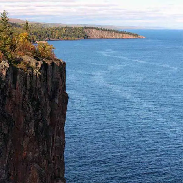
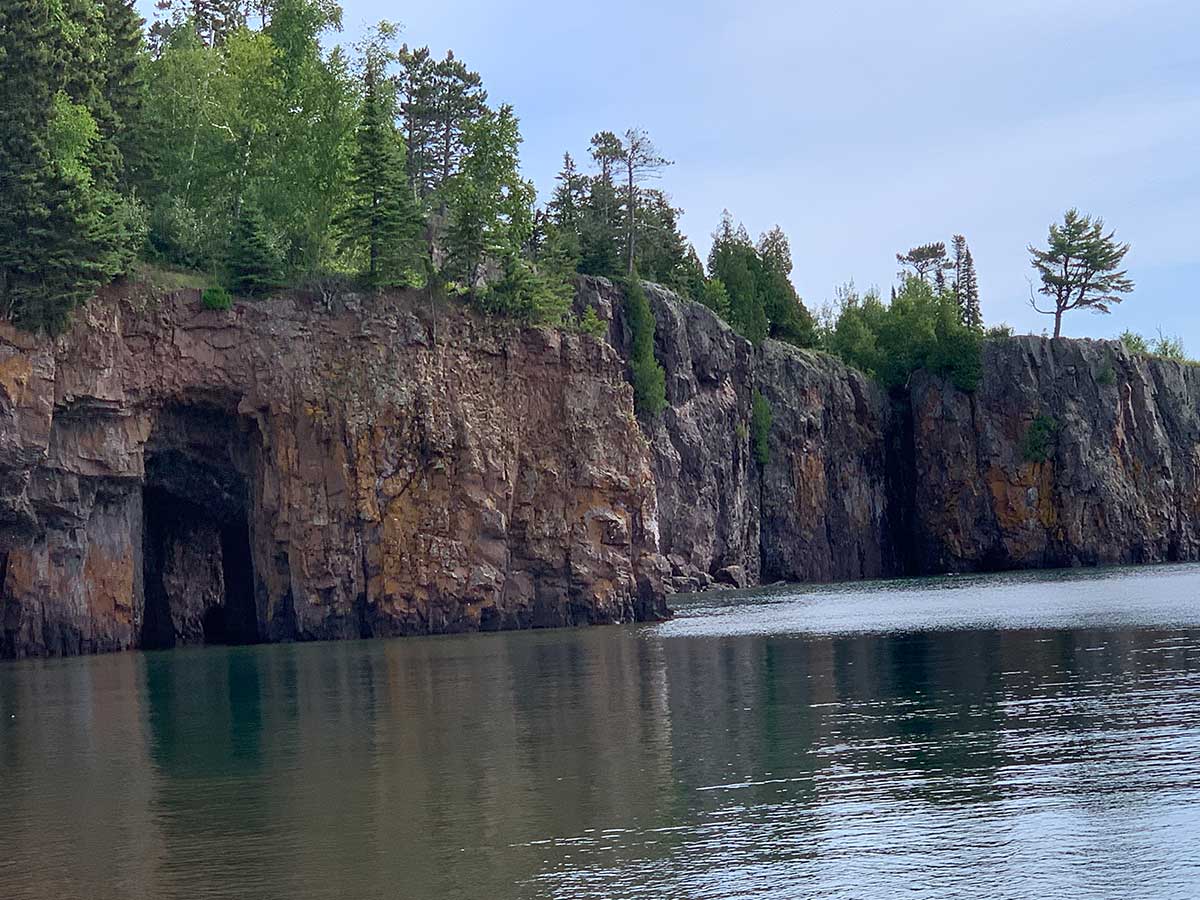
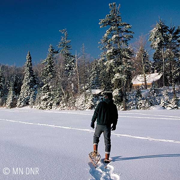
Here is a catch-all of things to do and see along the Minnesota North Shore Scenic Drive.

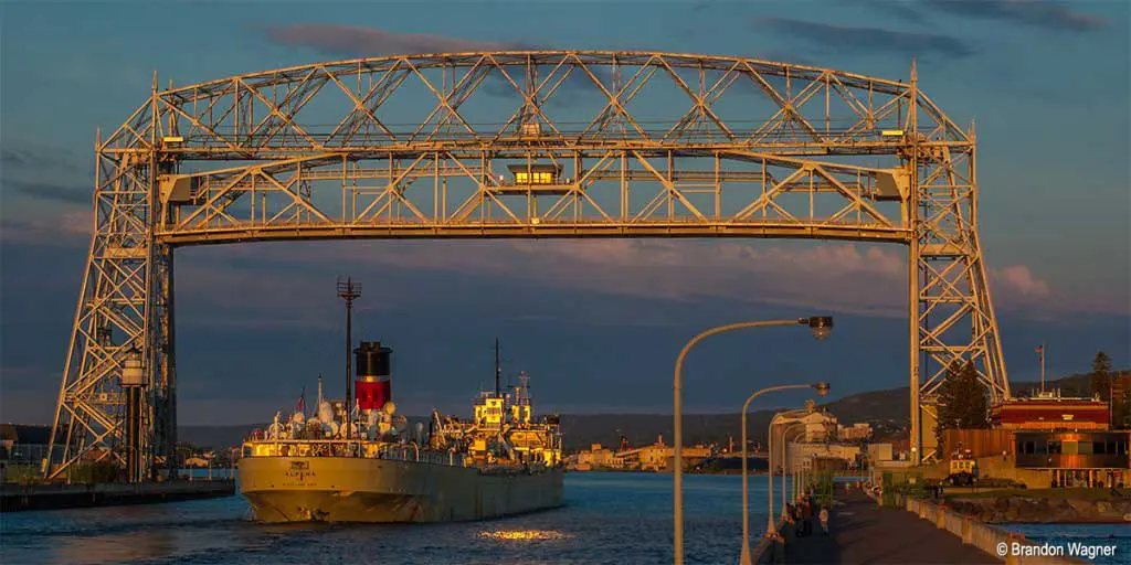
The North Shore Scenic Drive is an All-American Road. It stretches from Canal Park in Duluth, MN, along the shore, through the burgs and woodlands, to the international border at Grand Portage. You’ll even get a taste of what to expect in Canada.

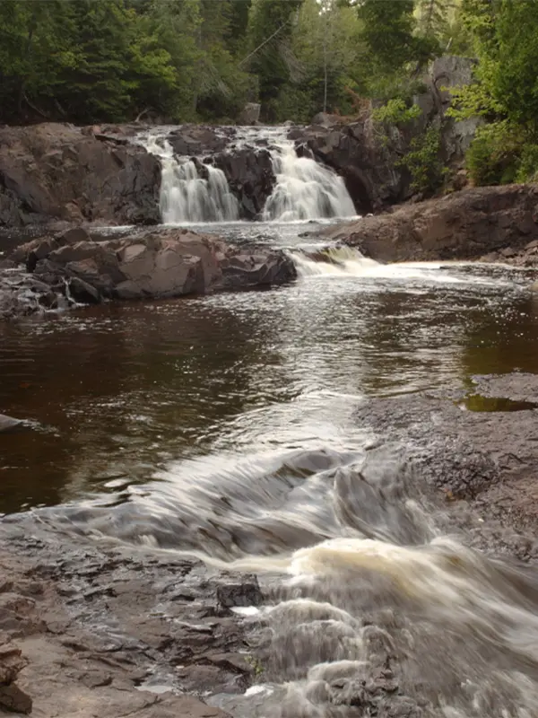
A few of the highlights you can expect on your north shore scenic drive include:

  • Unique, agate-studded black and pink cobblestone beaches
  • Fantastic spots to picnic and relax along Lake Superior
  • Three lighthouses, two harbors and many Lake Superior bays
  • The top fishing spots along the scenic north shore drive
  • Photogenic historical landmarks
  • A ghost town, a gondola and Grand Portage National Monument
  • Shops and eateries you won’t find anywhere else

This is just a sampling of what the north shore scenic drive in Minnesota has to offer. Get out and make your own discoveries! Note the mileage is indicated by the green mile marker signs posted every mile along Highway 61.

mile 0.0

The gargantuan counterweights slowly descend, raising the 900-ton span of the Aerial Lift Bridge, nearly 140 feet in the air. That allows the 1000-footers (ore boats carrying taconite pellets) and salties (ocean-bound ships) to pass into the harbor.

The canal was excavated in 1871 and is a deceptive 300 feet wide and 1,650 feet long. The first aerial transfer was erected in 1905 and modernized in 1929 to what you see today. It can rise to its full height in 55 seconds.

mile 0.0

The Lake Superior Maritime Museum houses actual-size replicas of a ship cabin, pilothouse, and massive steam engine. Exhibits and displays include several scale ship models. They list and announce all ship arrivals and departures, too. It’s free!

wintry ski in ski out townhomes at caribou highlands lodge at lutsen mountains
mile 5.2

Part of Kitchi-Gami park; Brighton Beach is perfect for skipping stones, agate-hunting, ship-watching, wading, picnicking and lollygagging. Features summer-use restrooms, picnic tables and grills. Brighton Beach starts just past the little blue tourist info center and runs 0.8 miles to Scenic 61/Congdon Blvd.

Note North Shore beaches are pebble or cobblestone; for sand, head to Park Point In Duluth.

Brighton Beach Road is closed to traffic as improvements to the park and shoreline are underway. To access, park at the visitor center parking near the mouth of the Lester River or a small parking area on Scenic 61.
mile 10.0

McQuade Harbor Rest Area is a spanky little safe harbor. W You’ll find a boat launch, kayak ramp, restrooms, interpretive panels, shelter, and paved walkway with a tunnel to the east b.breakwall. It includes three fishing platforms. Nice spot for a picnic, shore casting, or a little leg-stretcher.

mile 11.5
modern interpretive display panels at french river with lake superior in the background

French River Wayside Rest Area

The interpretive panels at French River Wayside Rest give a snapshot of the creation of Scenic 61/Congdon Boulevard plus local commercial fishing history on Lake Superior. The site has an easy walk down to a gravel swimming beach making it an ideal place to cool down on those 12 hot days of the year.

A fish sanctuary from the mouth of the French River to the four-lane freeway is in place. The MN Department of Natural Resources traps adult rainbow trout, sometimes referred to as steelhead. The big steelhead run happens from late October into November, with a smaller spring run in April.

Eggs are removed and sent to a Minnesota hatchery, where offspring are raised and returned to Lake Superior. The hatchery fish have their adipose fin (the one on the back between the dorsal fin and tail) clipped. Unclipped fish are native and have naturally reproduced.

steelhead, rainbow, kamloops trout – what’s the difference?

Rainbow trout and steelhead are the same species. Steelhead live in saltwater and spawn in freshwater streams, while rainbows live in freshwater.

Pacific steelhead fish were introduced to Lake Superior in the 1890s. Rainbows raised in a hatchery and released are also known as Kamloops or ‘Loopers. Unclipped/native fish can never be harvested when fishing.

mile 14.3

Stop at the old Blue Bird Landing beach on Lake Superior and cast for trout and coho [salmon]. Keep an eye out for freshwater whales, too.
You can also fish the 10.8 Talmadge and 15.7 Sucker Rivers. License required.

aerial view of grand marais harbor marina and campground
mile 15.8

Stoney Point Scenic Drive is a brief one-mile dirt road edging Lake Superior off Scenic Highway 61. It is ideal for wave-watching on stormy days, lake gazing and relaxing on calm days, and picnicking. You will find public access to the big lake toward the east end of the road.


mile 18.3

The little burg of Knife River MN includes a DNR marina, the river, a Lake Superior beach, rec center, and a few businesses. Originally founded as Buchanan, after President Buchanan, this unincorporated village has been home to commercial fishermen for the past 150+ years. During a spring gale in April 1914, 64-mile-per-hour winds proved too much for the 239-foot steel steamer Benjamin Noble, which sank off Knife Island.

mile 21.2

A small cluster along Scenic 61, the focal point of Larsmont is the Little Red Schoolhouse. On the National Register of Historic Places, it is a community hub for area residents. Stop and see what’s happening.

Interesting tidbit: Larsmont received its name in 1914 from an early settler who was originally from Larsmo, Finland.

mile 26.2

Visit the oldest operating lighthouse in Minnesota; on the National Register of Historic Places. Tour the Fog Horn Building, which focuses on fishing and shipwrecks, and a pilot house from the iron ore ship Frontenac. The light keeper’s quarters are now a B&B. The complex is part of the Lake County Historical Society.

mile 26.2

Walk from Agate Bay near the iron ore docks along a 1-mile paved walkway, the Sonju Trail, to Burlington Bay.

Agate Bay attractions include the Edna G tugboat, the Railroad Depot museum,  the Two Harbors Lighthouse museum and gift shop, and working ore docks – watch ships enter the harbor, dock and load up with pellets. Skip stones, picnic and search for agates along the cobblestone beach of Burlington Bay.

mile 27.5
flood bay state wayside

Walk the Beach

Flood Bay State Wayside offers a nice long pebble beach. Amble, search for agates, wade, picnic, relax. The walkway to the beach goes through a wetland that is sometimes home to waterfowl, otters, and beavers. Offers a seasonal restroom.


mile 39.5

For many this is the first big stop on their travels.  This four-season park offers accessible trails to rushing waterfalls, plus trails through the woods, along the river and to Lake Superior; naturalist programs, biking, fishing, fall colors, birding, skiing, plus shopping, exhibits, restrooms, and visitor info in a firelit lobby within the Visitor Center.

mile 42.6
iona's cobblestone beach lake superior

Go to the Pink Beach

Drive right up to this expansive beach, Iona’s Beach Scientific & Natural Area, which is bookended by cliffs, rhyolite,  and bedrock to the north and basalt to the south. Nor’easters work away at the northern cliff, breaking off shards of the pink rhyolite and washing them down shore. Once home to Twin Points Resort, the area is named after longtime owner Iona Lind.

Scientific and Natural Areas [SNAs] are natural resources that are rare or of exceptional scientific and educational value.

mile 46.0

Split Rock Lighthouse is the most well-known visual representation of the North Shore. Have you been? The Lighthouse, part of the MN Historical Society, offers a guided tour of the lighthouse, fog-signal building, oil house and lightkeeper’s house. The visitor center has gifts, exhibits and a brief video. Each November 10th, the beacon is lit at the Edmund Fitzgerald Memorial.

The adjacent state park has trails, camping, and alluring forests running down to the shoreline.

mile 50.3
line of shops and restaurants along a boardwalk in beaver bay minnesota

Beaver Bay

Enjoy the eclectic mix of shops and restaurants, then stop by the cemetery and pay your respects to legendary North Shore mail carrier John Beargrease.

mile 51.3

Stop by the new trailhead, check out the maps and make the short walk to admire views of the Beaver Falls, Beaver River, river mouth and bay. The river drops 300 feet in a series of cascades and falls above the Highway 61 bridge, then enters the sedate bay.

mile 53.7

Spacious slips for daily or seasonal rental, a picnic area, amenities in the marina shop, a short hiking path and a top-notch view of ships being loaded with taconite at Cliffs Natural Resources dock. The Silver Bay Marina plays host to the annual Salmon Classic fishing contest, too.


mile 54.8

This calm slice of shoreline gets its name from the taconite tailings [crushed rock] that make up the beach. Offering picnic tables, outhouses and both the Black Beach and an agate beach. New in 2020 is the adjacent campground.

mile 57.0

Palisade Head is a lakeside cliff with a stellar sweeping outlook over Lake Superior and up and down its shoreline. In the summer, drive to the top along a curvy tree-shadowed barely-two-lane road with limited parking and an occasional blueberry bush at the top. In winter, you can hike up the unplowed road. Stop at the Tettegouche State Park office for a permit if you wish to climb [gasp!] Palisade.

mile 58.5

Spread over 9300 acres, Tettegouche is a handful of overlapping parks including Lake Superior coastline, Baptism River and falls, inland lakes, hardwood forests, rugged topography PLUS 24/7 restrooms, a café and gifts, and charming fireside indoor and outdoor seating. Something for everyone!

mile 60.0

Lift your glass to this mythical Finnish saint who is cherished for leading the grasshoppers away from vineyards’ grapes. This is the perfect stop for people looking for something out-of-the-way, and a little less known. It is in Finland Minnesota. While the wooden carving of St. Urho is many feet high, keep an eye out, a leafy tree semi-obscures the statue from the road. When you’re done taking selfies, have a bite to eat in town.

St. Urho’s Day is celebrated the Saturday closest to March 16th. Finland offers up a hilarious beauty pageant, a parade, music, food and fun.

mile 73.3

Take a leg-stretcher along the 1-mile interpretive nature trail that departs from the parking area and includes a stop at Sugarloaf Cove on Lake Superior. The Interpretive Center has exhibits and artifacts from early logging operations in the area. See historic logging operation artifacts and take part in nature programs. The site is also a Scientific and Natural Area, home to unque geological and plant specimens.

The name sugarloaf comes from the craggy rocks jutting out of Lake Superior near the shore. Settlers purchased white sugar in cones aka sugarloaves, and the rocks in the cove reminded them of a partially used sugarloaf.

mile 75

For thirty-one years Taconite Harbor was home to families working the adjacent Erie Mining loading dock and power plant. When mining took a downturn in the 1980s, the company cleared the town for a new venture. Follow the road south of Highway 61. On the right you will see the remnants of main street,  including a few street lights and the basketball court. The end of the road takes you to an outdoor exhibit explaining the taconite operation, a public boat launch, safe harbor, and views of the rusting ore docks.

mile 78.8

Highway 61 spans the Cross River mid-waterfalls. While the drive-by view is nice, stop and walk the pedestrian bridge, an ideal vantage point for photos. Back in the day, the John Schroeder Lumber Company would dam the headwaters of the Cross River until spring, then shoot logs downriver to Lake Superior, where they were bound into rafts and floated over to Ashland and Superior, Wisconsin.

mile 80.4

Amazing river gorges that start a few feet inland from the highway, waterfalls, two foot-bridges, hiking, a cobblestone river mouth, camping and hiking. Hike a short way upriver to the amazing gorges, then return south of the highway and walk across the foot-bridge. During spring runoff or after rainy days, the river spray will mist you. Back in the day, this was the only river without a [sand] bar at the mouth, hence the name, Temperance.

mile 83.3

And how did they do it 100 years ago? Learn about commercial fishing, past and present, at the North Shore Commercial Fishing Museum, where many artifacts from families of the original Scandinavian settlers are on display. Continue your education via plaques along the lake walk edging Bluefin Bay.

mile 86.1

This perennial favorite, the Oberg Mountain Loop, starts off a short spur from the parking area and climbs at an angle up to western views down the shore, then panoramic Lake Superior views to the south, then northeast view up the shoreline, and finally northern views over Oberg Lake and the amazing maple-covered hillsides to the north. The trail meanders under maple and birch canopies, over bedrock slabs, and can be steep at times. The loop is 2.25 miles in total.

mile 90.5

Lutsen Mountains, the Midwest’s largest and tallest ski area, offers alpine skiers and snowboarders 95 sweeping runs over four mountains. Non-skiers can enjoy slopeside views and amenities at two chalets. Spring, summer, and autumn visitors can hike, bike, ride the gondola and alpine slide, and dine at the chalets.

mile 99.8

Cascade brings the river to you. A quick jaunt up well-maintained trails brings you to overlooks and a footbridge spanning the cascades. This is an ideal photo spot.

Picnic spots are a quarter mile farther along Highway 61. If you want to ski over the river and through the woods, Cascade has amazing cross-country skiing. Feel free to snowshoe anywhere, too.

mile 103.9

Heading northeast, just past Thomsonite Beach, Highway 61 curves left, revealing picturesque Good Harbor Bay, Seagull Rock, and, in the distance, Grand Marais. Use the pull off to admire the view and take photos. A quarter mile farther is Cut Face Creek Wayside, a nice spot for a picnic, an agate search, and skipping stones.

mile 109.6

Artist’s Point is the island and tombolo, a spit of land, that makes up the east side of the harbor, including the east breakwall and lighthouse; a drop of wilderness in the lake. So inspiring! Find picnic tables along the East Bay’s cobblestone beaches.

mile 115.0

No, but keep looking! Enjoy the wide-open vistas at Five Mile Rock, a landmark for early travelers. Listen to the waves lap, pick rocks, and see if anyone is fishing around the rock.(That’s five miles from Grand Marais, not five miles out in the lake).

mile 118.7

Relax, skip stones, and picnic on the beach. The there-and-back hike follows the Kadunce River with spurs to overlooks and pools. During the warm months of summer, when the water runs low, many locals hike up the river, including climbing the waterfall.

mile 123.8

The popular hike runs cliffside high above the Brule River. After a spur to the Lower Falls, make the final climb to where the splits. The eastern flow tumbles over the High Falls while the western arm drops into the Devil’s Kettle, final destination unknown. The hike is within Judge C.R. Magney State Park.

mile 130.0
boat access and small lake superior harbor

Horseshoe Bay

This sweet little bay is a Lake Superior safe harbor with boat access; no amenities; pack out what you pack in.

mile 143.3

Learn about the alliance between the Grand Portage Ojibwe and the North West Company during the fur trade boom in the late 1700s. at the Grand Portage National Monument. Explore the reconstructed stockade and great hall, the visitor center, garden and grounds, Mount Rose trail, and historic Grand Portage trail leading 8.5 miles inland to Fort Charlotte on the Pigeon River.

mile 150.8

It’s all about hiking to the 120-foot High Falls, but leave time for the exhibits, gift shop and interpretive signs in and around the Visitor Center, where you can learn about the culture and traditions of the Grand Portage Ojibwe people. Bring your camera.

Access to Grand Portage State Park is Free!

State Park Vehicle Permits are NOT required at this park.

mile 151.0

Cross the border and spend some time in Canada [passport/approved documentation required to cross the border]. Thunder Bay is 36 miles over the border; along the way are the Middle Falls Provincial Park, shops and farm stands, Old Fort William, and Kakabeka Falls. Canada is English-speaking, uses the same rules of the road, uses the metric system, has their own currency, and is in Eastern Time Zone, one hour ahead of Minnesota.

start your north shore scenic drive in duluth, mn

The North Shore Scenic Drive in Minnesota encapsulates everything that Lake Superior has to offer—but it’s so much more than the big lake!! This road trip brings you from touristy Canal Park in Duluth all the way up to the remote Canadian border. You’ll experience ships, shoreline, and all the natural beauty the area has to offer. Tourists and locals agree Minnesota’s north shore scenic drive is the ideal way to experience it all.

The MN North Shore scenic drive is just the beginning. Check out our events page so you can add a few fun extra stops to your north shore drive. Imagine ending your road trip with a view of the northern lights!

sparkling wintry lake superior and ice sheets stacked on north shore

Get North Shore travel tips delivered to your inbox