white lettering on orange background northshorevisitor.com com logo
Search
Close this search box.
Search
Close this search box.
snowy waves at mouth of cascade river state park

Cascade River State Park

Cascade follows the park tradition of bringing the river to you. Parking is at the mouth of the river and Superior’s expanse [and within the park, one-third of mile northeast on Hwy 61]. A quick-jaunt up well-maintained trails brings you to overlooks and walking bridges spanning the cascades. Like Gooseberry, Cascade touts its fishing and fall colors, but outdoes itself on its cross-country ski trails. If you want to ski over the river and through the woods, strap on your skinny skis at Cascade.

Park Overview

mile 100.8


Open year round 9am-3pm with extended summer hours; includes a Nature Store, firewood and ice.

The Lake Superior picnic area is east of the river and requires a park pass. Inland is a reservable enclosed shelter with picnic tables, a wood stove and a beverage vending machine. This acts as the winter warming house.


3481 Minnesota 61 | Lutsen
218-387-6000

Cascade Area Camping

mile 100.8
State Park Campground

40 drive-in sites: 21 electric, 19 non-electric; 4 are pull-through sites, 35' RV length limit.
5 backpack sites from 0.5 to 1.5 miles from parking.
2 group camps [tent only; located 75 yards from parking].
Seasonal accessible showers and flush toilets, and dump station.
3 electric and 3 non-electric sites and vault toilets open year round.
Firewood for sale at office; ice for sale seasonally at office.
2023 payment update for camping and firewood
Reservations


3481 West Highway 61 | Lutsen
218-387-6000

Spring, Summer, Fall Activities

mile 86.6

Climb the wooden steps and hike above the river to view the cascades near the river mouth then continue another 1/2 mile to see the Stair Step Falls. Can only be seen before the trees leaf out and is best in spring when the river rushes. Easy to follow trail from parking at the Ray Berglund Wayside and Recreation Site.

mile 99.8

Ten miles above Highway 61 Cascade River begins its descent to Lake Superior. Dropping 900 feet in the lower three miles, the river takes a steep final run in the last quarter mile as it drops 120 feet through a deep, churning gorge. See the Cascade Falls and cascades on an easy loop that includes overlooks and a foot bridge with excellent views of the falls. The loop that includes the falls, cascades and bridge over the river is about 1/2 mile; you can extend your hike on either side of the river.

mile 86.1

While this is the trail to hike during autumn’s early season of maple colors, it is fantastic spring, summer, and winter, too. This trail begins with a spur, which connects to a loop around Oberg Mountain’s upper edge. Overlooks include views of adjacent LeVeaux Mountain, Lake Superior, the maple hillsides, and Oberg Lake. Enter the maple woods and hike under the canopy of birch and maple before you begin the 2-mile loop. Plan on a busy trail filled with happy hikers – the views will do that.

Length: 2.25 miles
Difficulty: moderate with steep climbs and open rock cliffs

mile 90.5

Waterfalls, woods, wide-open vistas and an optional tram ride make this hike rather spectacular. For the downhill version, ride the tram over the Poplar River and up the east face of Moose Mountain. At the top, head to the chalet for 180-degree views of Lake Superior, the shoreline, and maybe on a clear, low-humidity day, the south shore of the lake.

Hill top trails [about a mile total] allow more perspectives on the lake views, and a stunning overlook gives 180-degrees northern views of maple hillsides, especially stunning in the autumn. From the top of the hill, take the Superior Hiking Trail down the ridge to the top of Mystery Mountain for another overlook, then into the woods to the falls of the Poplar River. After crossing the river, when you hit the gravel road, take it to the south to the main parking area at Papa Charlie’s at Lutsen Mountains. You can, of course, start here, hike up and hike/ride the gondola back.

Purchase your gondola tickets

Length: 1.0+ if you take the gondola over; up to 12.2 mile to hike the entire loop
Difficulty: easy to difficult

mile 92.8

A 230-foot climb in under a quarter mile brings views of Caribou Lake, and the thick maple forests surrounding it. This little hikes leads to a spur trail of the Superior Hiking Trail [SHT]. Look for the SHT trail sign on the left side of the lot, and follow the trail, which leads right to the Caribou Trail; cross the road and follow the trail to the top. This east-facing overlook makes for a pretty sunrise spot, too!

From Hwy 61, turn north on the Caribou Trail/Co Rd 4 for 4 miles to the small parking area on the left; if you come to the boat launch, you’ve gone too far.

framed wintry view of lake superior shoreline at grand superior near gooseberry falls
mile 101.3

Choose your own hike length. For a shorter jaunt with river views from above, head north 1 mile to the North Cascade River Camp. Or hike down the east side of the river a half-mile or more for picturesque riverside views of cliffs under old growth cedars.

The big loop, 6.8 miles is down the east [or west] side of the river, crossing on the footbridge and returning north. This hike has you descend just over 1000-feet and climb just over 1100-feet. A 3.6-mile option is to leave a car at the Highway 61 parking near the river mouth, then take another vehicle to the trailhead and hike downriver and downhill.

Cascade Mountain, pictured here, is visible from the parking area.

Length: 1-8.8 miles
Difficulty: moderate to difficult for length

Winter Activities

mile 86.1

This incredibly popular fall color hike trail showcases multiple overlooks, making it a worthy destination any time of year. It begins with a spur, which connects to a loop around Oberg Mountain’s upper edge. Overlooks include views of adjacent LeVeaux Mountain, Lake Superior, maple hillsides, and Oberg Lake. Enter the maple woods and hike under the canopy of birch and maple before you begin the 2-mile loop.

Note: at the other end of the parking lot is the trail to LeVeaux Mountain which is a good place to snowshoe, however it is hard to keep on the trail in the winter as the signage assumes you can see the dirt path.

Length: 2.25 miles
Difficulty: moderate with steep climbs and open rock cliffs

mile 92.7

The Lutsen trail system spans diverse topography. Set just below the ridgeline, trails connect Tofte and Lutsen, wind behind Oberg Mountain, roll over heavily timbered land, feature several scenic overlook areas, and connects to the North Shore State Trail.

Length: 67 miles

mile 99.8
Cross-Country Skiing

Cascade State Park is criss-crossed with 27K of cross-country ski trails ranging from easy to difficult. I like skiing up the east side of the river and connecting to the inland loops. It offers terrain, gorgeous cedar stands and wildlife sightings.

A few options – make it a two-car ski and start at the Upper Cascade River, skiing riverside then through forest downhill to Highway 61. And, if the ice is thick and you know what you’re doing, you can ski on the river from the Upper Cascade parking area to above the waterfalls.

Snowshoeing

Cascade State Park is criss-crossed with cross-country ski trails which are off limits to snowshoers. That leaves tons of acreage for you to roam. Follow the hiking trail [poles are helpful for inclines and slippery spots] for views of the cascades and falls, then meander away. My favorite – the Lookout Mountain trail; you climb through dense forest, see rivers, and make a final ascent though a sparse birch forest before reaching the top. There’s even a little camp shelter to sit a spell and have a snack before a fun descent.

Length: varies
Fees: MN Ski Pass required
Difficulty: easy, more & most difficult
Amenities: restrooms in State Park; the main trail shelter in the park may be heated by wood stove as needed; unheated rustic shelters are located at backpack campsites along the trail; and, Cascade Lodge Restaurant & Pub is at the trailhead of the east side system

mile 99.8
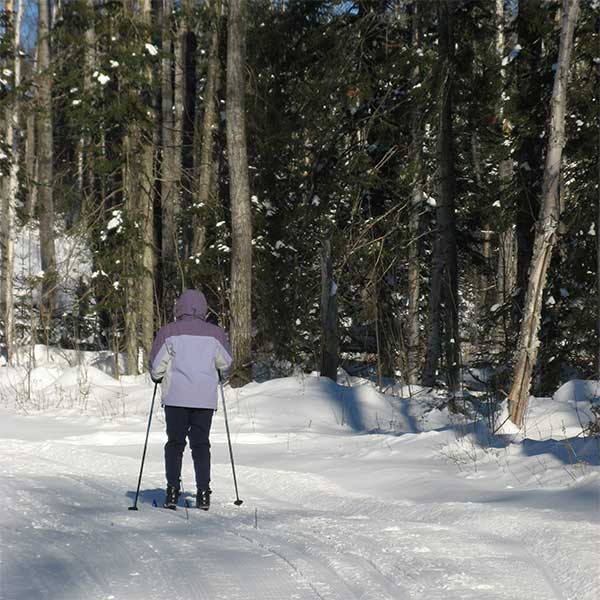
cross country skiing

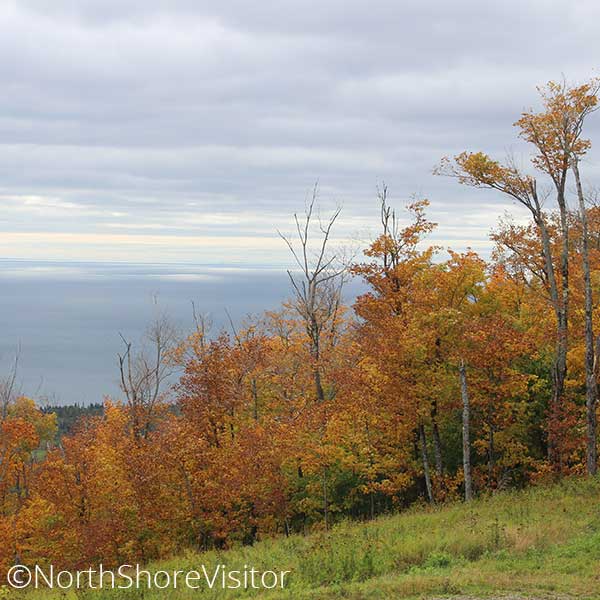
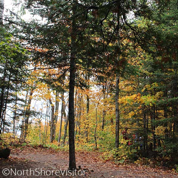
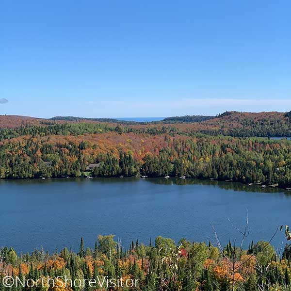
The trails wind through mature maple forests, mixed evergreens, and in the midst of wildlife.  A number of the trails have spectacular view of Lake Superior and connect up to the Cascade River State Park Trails. From the north trailhead [earlier and later season snow] ski Deeryard Loop to the old Cascade Fire Tower; you can connect to the Pioneer Loop and work your way all the way down to Highway 61 at the Cascade River making this an excellent 2-car ski. Trails then connect to Cascade River State Park Trails and continue west on a connector trrail to the Hall Massie Loops

Click above for the main trail map and here for the Hall-Massie/Connecter trail map

snowshoeing

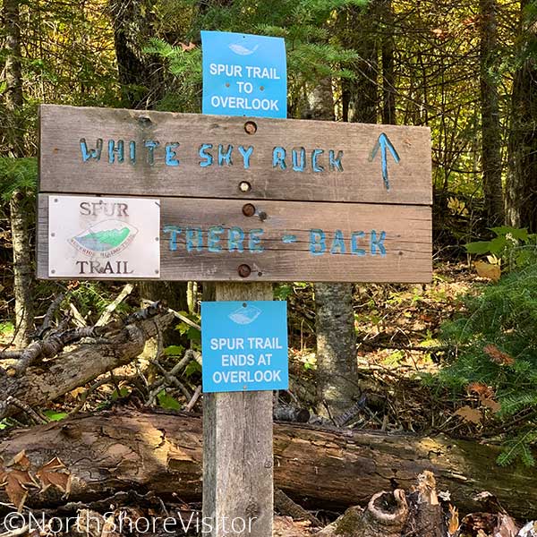
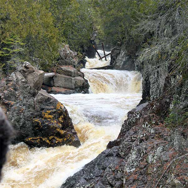
Follow the there-and-back trail along the east side of the Jonvick Creek for a nice wooded walk with some elevations.

fat bike trails

Ride a trail paralleling Highway 61 then riding near the west side of Cascade River; return and continue another 3.6 miles to the 1.0 mile Whitesides and Deer Track Loops.

Length: 65.3K ski trails, about 6 miles Fat bike Trails and 1 mile snowshoe trrail
Fees: MN Ski Pass required
Difficulty: easy, more & most difficult

spiral waterslide and pool at americinn silver bay on the north shore
State Park Events
sparkling wintry lake superior and ice sheets stacked on north shore

Get North Shore travel tips delivered to your inbox