Peak Maple Fall Colors drives
North Shore Fall Color Itinerary
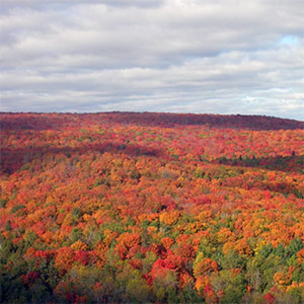
The best time to see peak maple fall colors on the North Shore is generally between September 21 and October 15. So now that you know when, where are the best peak maple fall color drives? We give you all of our choices for an ideal North Shore Fall Color Day below, so you can make your perfect fall color itinerary.
Peak Fall Color Itinerary Tips
Start with this year’s fall color information: see the current fall color report.
You will find maple forests from Beaver Bay to northeast of Grand Marais on the hillsides facing Lake Superior and the next set of inland ridges.
For the best viewing, drive west [towards Duluth] in the morning and east [towards Grand Marais] in the afternoon. This keeps the sun at your back.
Don’t let a light rain, mist or fog deter you. While the panoramic vistas won’t happen, nature takes on a soft watercolor aspect that is quite stunning.
Pick an area and go for a drive. Leave time to pull over, admire the scenery and take photos.
Take a break in the nearby towns for lunch and shopping.
Get a general North Shore map to orient yourself. Trail maps are included in each description below.
No go make some colorful memories!
The Best Three Peak Fall Color Drive Itineraries
Recommended Restaurants
mile 26.0 + 0.3 miles
Beer & Wine
Casual
623 First Avenue | Two Harbors
mile 37.0
Brewery/Bar/Winery
Family-friendly
Casual
Fine Dining
Grand Superior Lodge, 2826 Minnesota 61 | Two Harbors
218-834-3796
mile 50.2
Beer & Wine
Family-friendly
Casual
4614 Minnesota 61 | Beaver Bay
218-226-4036
mile 82.6
Brewery/Bar/Winery
Family-friendly
Casual
Fine Dining
7192 Minnesota 61 | Tofte
218-663-6200
mile 90.2 + 1.4 miles
Brewery/Bar/Winery
Family-friendly
Casual
Caribou Highlands Lodge, 371 Ski Hill Road | Lutsen
218-663-3020
mile 109.5
Brewery/Bar/Winery
Casual
233 West Highway 61 | Grand Marais
218-387-3163
Two Harbors to Tettegouche Backroads
If you are on the southwest part of the shore, combine these paved backroads drives into a fall color bonanza. Depart from Two Harbors, and lollygag up to Illgen City with time to drive into Tettegouche for Lake Superior views, bathroom and gift shop stop. This route is easily reversible. Either way return via Highway 61.
This route explores the backcountry including northern hardwood forests of oak, maple and basswood and boreal forests of pine, spruce, cedar, aspen and birch. It’s a great way to get off the highway and go for a country drive – all paved roads. From Two Harbors, drive northeast on MN-61 to Lake County 3, stay on this road – it turns into the Airport Road – until the T and head south on the Lax Lake Rd to Beaver Bay.
Consider continuing behind the ridge line by heading north on the Lax Lake Rd and following the directions of the Beaver Bay to Illgen City route.
31.9 miles to Beaver Bay and 25 miles return on Highway 61 to Two Harbors
This route explores the backcountry including northern hardwood forests of oak, maple, and basswood, and boreal forests of pine, spruce, cedar, aspen and birch. You will ascend to the top of the hills, then drop down for a woodland drive. Watch for deer – and maybe a rare moose – on this winding, low-traffic road. I suggest starting in Beaver Bay and working counterclockwise so you can enjoy the views descending MN Highway 1 towards Lake Superior and Highway 61.
This drive is lovely anytime during the season, showcasing ridge line maples early and poplar and birch later.
Option: at MN Hwy 1, turn left and go to Finland for a visit and lunch; return on MN Hwy 1, or on Co Rd 6, where the final few miles of descent are also impressive. All roads are paved. Click on the map for a larger
Spread over 9300 acres, Tettegouche is a handful of overlapping parks including Lake Superior coastline, Baptism River and falls, inland lakes, hardwood forests, rugged topography PLUS 24/7 restrooms, a café and gifts, and charming fireside indoor and outdoor seating. Something for everyone!
Lutsen Backroads
Heartbreak Ridge is a picturesque dirt road drive under canopies of maple trees – lovely! The return is down the paved Sawbill Trail to Highway 61 for a quick drive to Moose Mountain for a gondola ride – stunning! Cap off the afternoon with a longer drive on dirt roads behind Lutsen.
Make this fall color tour drive number one your list. It is breathtaking. The short drive leads you down one of the prettiest maple canopied drives along Minnesota’s North Shore. A roadside plaque explains how Heartbreak Ridge was named. The final descent into Tofte offers a glimpse of the Tofte cemetery and views of Lake Superior. The Sawbill and Hwy 61 are paved; the other roads are gravel. 18 miles total
Waterfalls, woods, wide-open vistas and an optional tram ride make this hike rather spectacular. For the downhill version, ride the tram over the Poplar River and up the east face of Moose Mountain. At the top, head to the chalet for 180-degree views of Lake Superior, the shoreline, and maybe on a clear, low-humidity day, the south shore of the lake.
Hill top trails [about a mile total] allow more perspectives on the lake views, and a stunning overlook gives 180-degrees northern views of maple hillsides, especially stunning in the autumn. From the top of the hill, take the Superior Hiking Trail down the ridge to the top of Mystery Mountain for another overlook, then into the woods to the falls of the Poplar River. After crossing the river, when you hit the gravel road, take it to the south to the main parking area at Papa Charlie’s at Lutsen Mountains. You can, of course, start here, hike up and hike/ride the gondola back.
Length: 1.0+ if you take the gondola over; up to 12.2 mile to hike the entire loop
Difficulty: easy to difficult
Ideal for casual bikers, this trail follows the Honeymoon Trail gravel road from east to west from the Caribou Trail to the Sawbill Trail through maple forests [great autumn ride!]. After a short ride down the snowmobile trail, you continue past Christine Lake, cross the Poplar River and begin the hilly part of the ride. When you finish, cool your feet off in the Temperance River.
For this point-to-point ride, you will need to get picked up/leaver another vehicle at the Temperance River Campground, 11.2 miles north of Hwy 61 on the Sawbill Trail.
Length: 10 miles
Difficulty: moderate
Trailhead: snowmobile trail parking, Caribou Trail
Surface: snowmobile trail, then gravel road
Grand Marais Backroads
These routes combine to give you the best of peak fall colors in Grand Marais. Start with the Upper Cascade there-and-back route, then head to Pincushion for the overlooks, Maple Hill for charm and County Road 60 and/or Trout Lake Road [both dirt roads] for some maple backwoods beauty.
Choose your own hike length. For a shorter jaunt with river views from above, head north 1 mile to the North Cascade River Camp. Or hike down the east side of the river a half-mile or more for picturesque riverside views of cliffs under old growth cedars.
The big loop, 6.8 miles is down the east [or west] side of the river, crossing on the footbridge and returning north. This hike has you descend just over 1000-feet and climb just over 1100-feet. A 3.6-mile option is to leave a car at the Highway 61 parking near the river mouth, then take another vehicle to the trailhead and hike downriver and downhill.
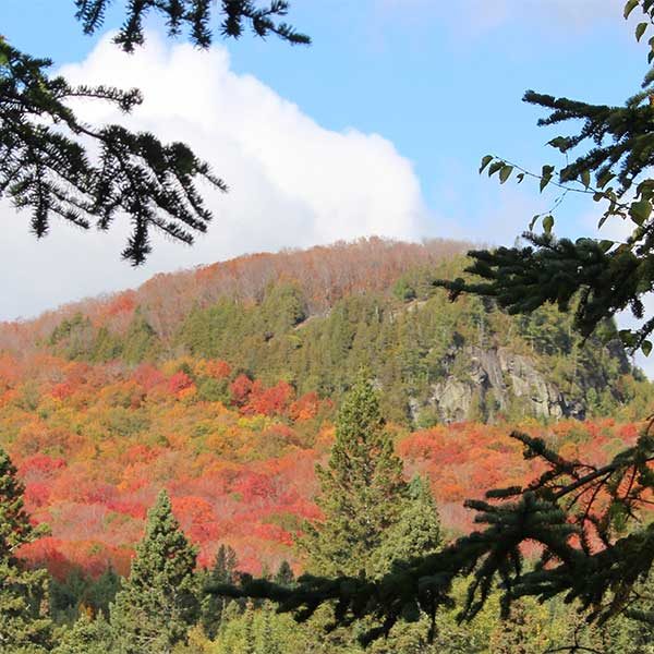
Cascade Mountain, pictured here, is visible from the parking area.
Length: 1-8.8 miles
Difficulty: moderate to difficult for length
gunflint mile 4.5

Maple Hill Church
Picturesque and charming Maple Hill Church sits center stage surrounded by its namesake maples. Visitors appreciate the peaceful beauty of the grounds, especially during fall colors. A gathering place for over a century, the church is now home to Spirit of the Wilderness Episcopal Church which has services Sunday mornings. Otherwise, it is pretty quiet.
The 1897 cemetery is watched over by a thick-trunked, sprawling maple. Amble the grounds. The original church was built in 1902 and served the Scandinavian settlers. East and West Maple Hill were established by mainly by Swedes and Norwegians in the late 1800s. David Caribou, his family and two other indigenous families lived in the area at the time and shared their established pathways down to Grand Marais.
Arson destroyed the church on Christmas Eve 1986. Descendants of the original settlers rebuilt on the original footprint. Tucked on the backside of the ridge rising north of Grand Marais, it is four miles inland from Lake Superior making it an easy add-on to your day, or the perfect first stop on your way up the Gunflint Trail.
Why Stop
Close to Grand Marais | Serene | Historical | Fall Colors | Photogenic
Wait, There’s More!
All the Fall Color Drives & Trails | Fall Color Report | Lodging Specials
Hiking, biking, skiing and snowshoeing making Pincushion Mountain trails the Grand Marais trail system. Close to town, lots of spur options and expansive views make this an ideal hiking location. My #1 recommendation is the hike to the summit of Pincushion Mountain, pictured here. Use the map. There are loads of intersections and it is easy to get confused. You will follow the Superior Hiking Trail on the Pincushion Loop, then take the spur trail to the the peak. You will come to an overlook — appreciate it — but keep going, the views open up to 270-degrees just a bit further along. Return on the Pincushion Loop making this a 4.5 mile hike.
The hike follows cross-country ski trails so is a nice wide trail through birch with some low areas, moderate ascents and nice pines. Hike the 25K of cross country ski trails or the new bike trails (give right away to bikers, though!). The Superior Hiking Trail also crosses through the trail system and the overlook offers panoramic views of Lake Superior and Grand Marais. Trails have lots of junctions, so consider bringing a print map.
Mountain Biking
Seven narrow hard-pack trails intersect and climb the wooded hilltop overlooking Grand Marais and Lake Superior. The easy Pincushion Mountain Loop includes a small spur hiking trail to the summit. Test your skills on the advanced loops which connect to the intermediate loops.
Length: varies, 4.75 miles for Pincushion Mtn loop and spur to summit; 20 miles of bike trails
Difficulty: easy to more difficult due to length
Surface: hard pack and rock
The Trout Lake Road / County Rd 60 loop is a lovely drive, with beautiful sugar maple-lined sections of the road, often with their canopies meeting overhead. The mixed landscape give multiple perspectives of fall colors. Most impressive during the early maple season, you will drive under canopies of maple trees – almost tunnel like as well as have views of distant hillsides and adjacent forests. This drive provides a few side stops, too.
The road passes directly along the south shore of Mink Lake with views across the lake to the low fall-color patchwork hillside on the north. Want to stop for a longer views or a picnic? The Mink Lake Public Access is 500 feet north of the Trout Lake Road. Another picnic, hiking, camping stop is the Kimball Lake Campground which is about 500 feet to the south of Trout Lake Rd. Watch for the federal campground sign. And the more adventuresome can drive the one-mile steep Bogus Lake Road through maples to some peek-a-boo views.
You can drive this clockwise or counterclockwise. TIP – in the morning drive counterclockwise, and choose clockwise in the afternoon to keep the sun at your back for part of the time.
why stop
Close to Grand Marais | In the Woods | Picturesque | Varied Landscape
Check out these North Shore Favorites
upcoming events
