white lettering on orange background northshorevisitor.com com logo
Search
Close this search box.
Search
Close this search box.
maples at peak at oberg mountain north shore shore

Peak Maple Fall Colors Hikes

Peak maple fall colors happen first, generally between September 23 and October 9. Get the current fall color report. You will find maple forests from Beaver Bay to northeast of Grand Marais on the hillsides facing Lake Superior and the next set of ridges.

Hiking during peak fall colors is absolutely fantastic. No bugs, crisp mornings, warm afternoons. Wear a few layers and for best viewing on sunny days hike to the west [towards Duluth] in the morning and to the east [towards Grand Marais] in the afternoon. This keeps the sun at your back. But don’t let a light rain, mist or fog deter you. While the panoramic vistas won’t happen, nature takes on a soft watercolor aspect that is quite stunning.

Itinerary Tips

Plan on a hearty breakfast, lunch or both. Our recommendations below.
Make a stop at the local grocery store, co-op or convenience stop for trail snacks.
Plan on one, two, or three hikes!
Get a general North Shore map to orient yourself. Trail maps are included in each description below.

The Best Three Peak Maples fall color itineraries

mile 27.3

Fine Dining


1521 Superior Shores Drive | Two Harbors
800-218-8589
mile 82.9

Baked Goods

Coffee

Family-friendly

Casual

Deli


7128 Minnesota 61 | Tofte
218-663-8032
mile 99.7

Brewery/Bar/Winery

Family-friendly

Casual

Open daily 8am-8pm year round


3719 West Highway 61 | Lutsen
218-387-1112
mile 109.7 + 0.1 miles

Baked Goods

Family-friendly

Casual


20 wisconsin Street | Grand Marais
218-387-1597
mile 109.7 + 0.1 miles

Baked Goods

Family-friendly

Casual


16 Wisconsin Street | Grand Marais
218-370-1417
wintry ski in ski out townhomes at caribou highlands lodge at lutsen mountains

Big Colors, Big Peaks

Hike up, up, up the ridges and you will be treated to 270• wide open vistas of miles of maple covered hillsides, Lake Superior or the Baptism River Valley, rock cliffs and all around autumn splendor.

These three hikes are centered mid-North Shore from Tettegouche to Tofte.

mile 58.9

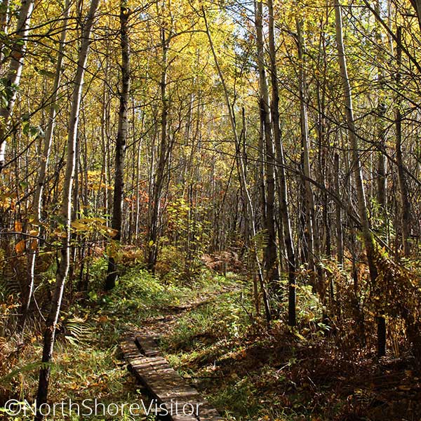
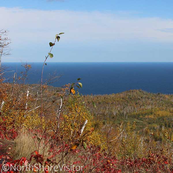
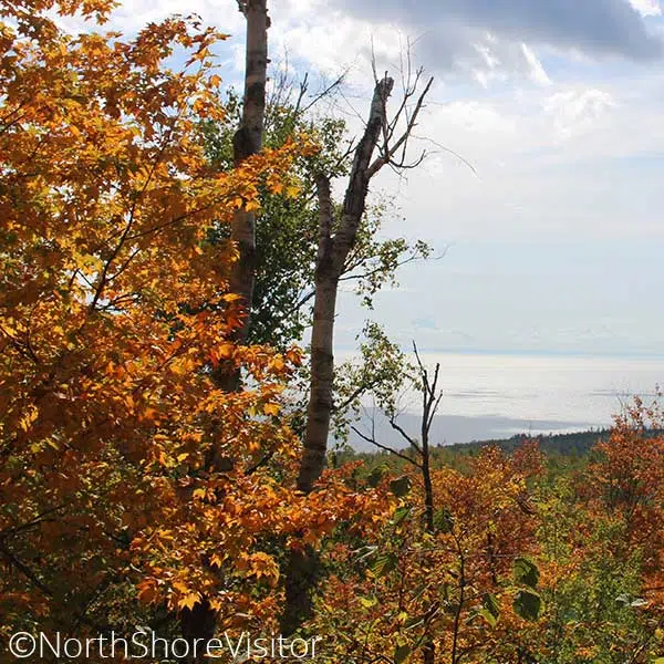
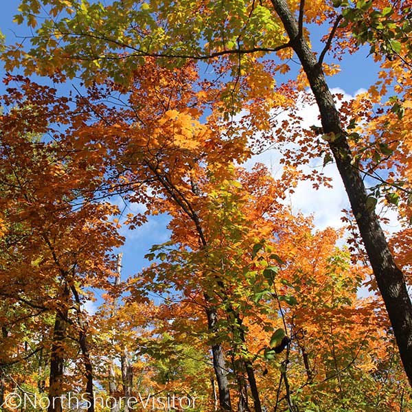
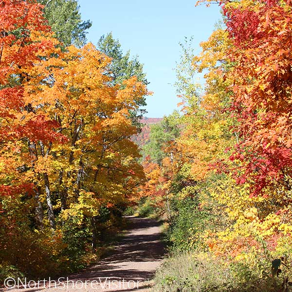
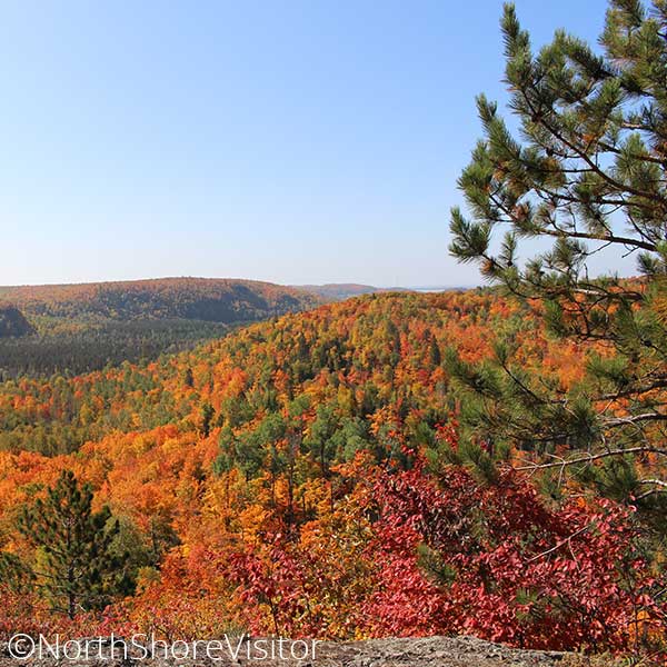
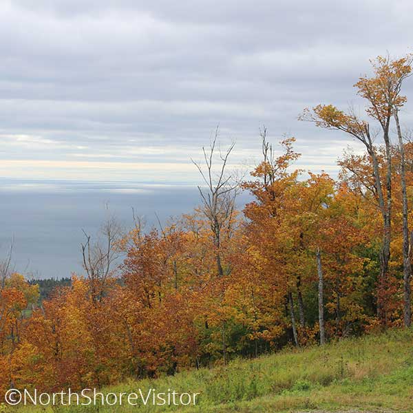
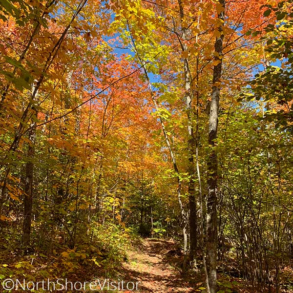
This hike is fantastic during fall colors, and great in the spring before the leaves pop. You will hike inland a mile, climbing in elevation. About the time you want to take a breather, there’s an overlook of Lake Superior – nice, but nothing compared to the view from the spur trail you take to the north. This narrow, windy trail can be slippery when wet, especially on the bare rock portions of the trail. The first overlook is outstanding, with 270-degree views all along the shore and inland.

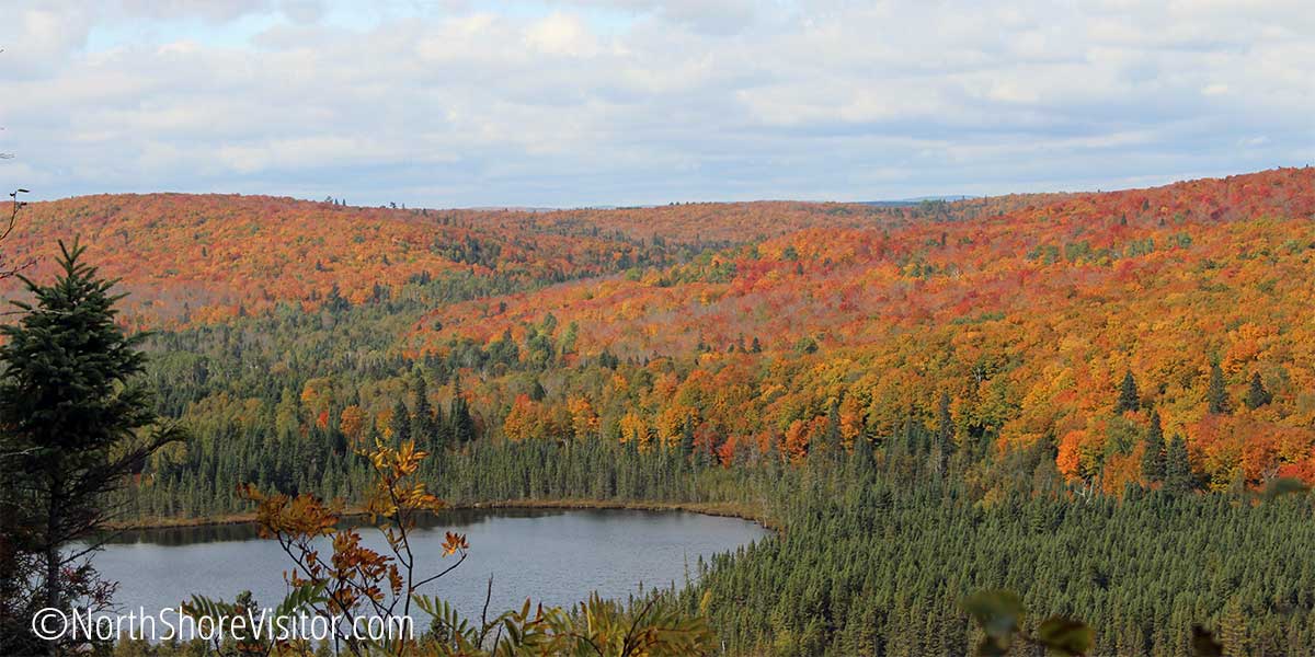
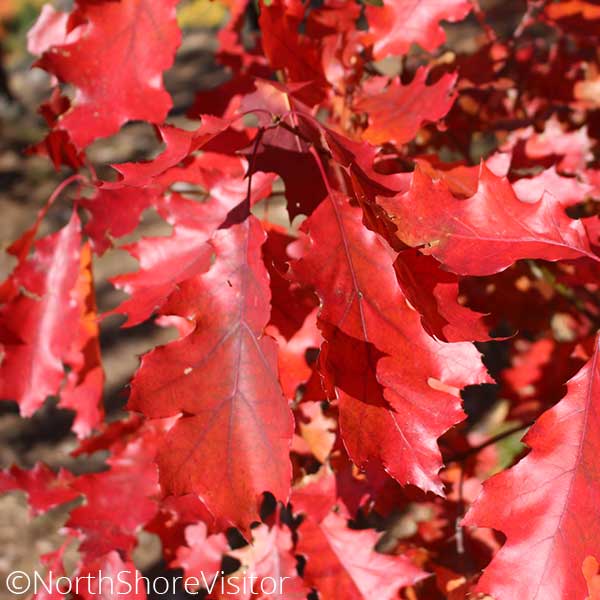
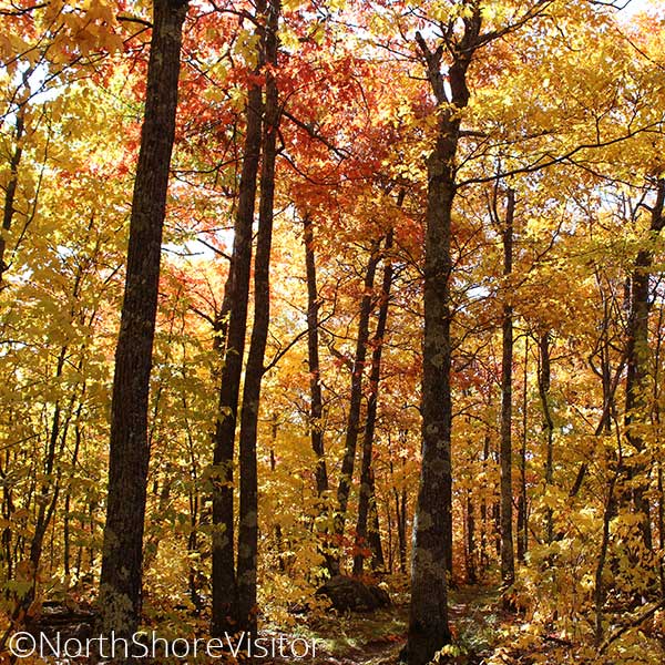
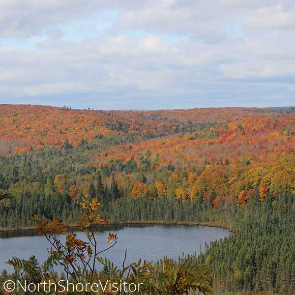
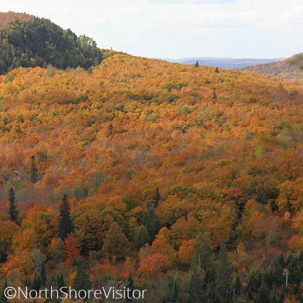
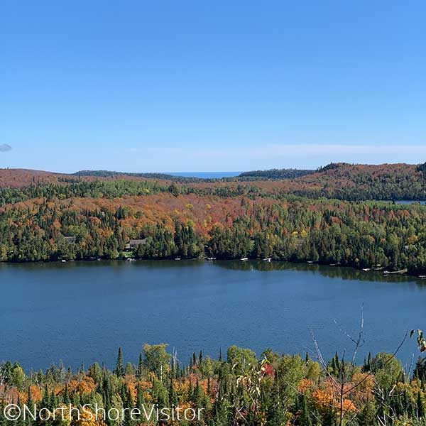
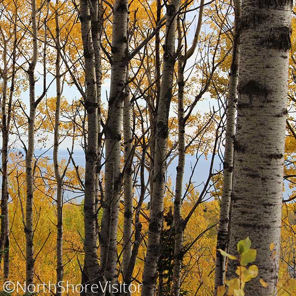
Continue on around the exposed knoll to the north. After a short jaunt through pretty woods, you come to a northern overlook which overlooks distant maples hillsides while at your feet, the cliff drops away to a slough; breathtaking.

Length: 3 miles
Difficulty: moderate, steep and in inclement weather difficult due to exposed slippery rock

mile 66.0

Hike through boreal forests before climbing maple ridges that showcase magnificent fall colors and impressive rock cliffs with view to the Baptism River valley. The trail is 4.5-mile round trip.

From Highway 61, drive north on Lake County Road 6 for for 2 miles to the Superior Hiking Trail sign and parking.
*Bonus: on the drive back down Co. Rd 6, stop on the southbound gravel pull off just before the guard rail starts, for an excellent view of the big lake.

mile 83.4

If you’re willing to hike up a hill, you’ll be rewarded with views of the maple and pine covered hills rolling down to Lake Superior, which stretches for miles to the south. Hike under maple and birch canopy before stepping out on a large basalt overlook.

The trailhead is the hub for many hiking options: east to LeVeaux Mountain, west across the Sawbill Trail to the top of Carlton Peak, adjacent mountain cross-country ski trails, and/or bring your bike for the single track trails.

Length: 0.5 miles
Difficulty: moderate due to steepness

Climb & Ride

Make it a combo – hike the glorious back side of Tettegouche State Park, then take the gondola to the top of Moose Mountain [at Lutsen Mountains] and cap off the day with the most popular North Shore fall color hike, Oberg Mountain.

mile 58.9

One of my favorite medium hikes! The Tettegouche Lake loop is part of a trail system accessed on the back side of Tettegouche State Park. It begins with an old road bed climbing 285-feet over three-quarters of a mile, includes four overlooks and a dip down to the historic Tettegouche Camp [where cabins are available for rent]. I like to go counter clockwise from the junction and see the overlooks, then take a little break at the Camp where I decide if I am going to add on more loops or head back. In the autumn, consider the ‘circling the lakes’ as the valleys are filled with colorful maples!

Length: 3.5 miles
Difficulty: moderate to difficult due to hills

Driving directions can be funky: from Highway 61, drive north on MN 1 for 4.3 miles, turn left on Lax Lake Rd for 3.1 miles, parking will be on left.

mile 86.1

While this is the trail to hike during autumn’s early season of maple colors, it is fantastic spring, summer, and winter, too. This trail begins with a spur, which connects to a loop around Oberg Mountain’s upper edge. Overlooks include views of adjacent LeVeaux Mountain, Lake Superior, the maple hillsides, and Oberg Lake. Enter the maple woods and hike under the canopy of birch and maple before you begin the 2-mile loop. Plan on a busy trail filled with happy hikers – the views will do that.

Length: 2.25 miles
Difficulty: moderate with steep climbs and open rock cliffs

mile 90.5

Waterfalls, woods, wide-open vistas and an optional tram ride make this hike rather spectacular. For the downhill version, ride the tram over the Poplar River and up the east face of Moose Mountain. At the top, head to the chalet for 180-degree views of Lake Superior, the shoreline, and maybe on a clear, low-humidity day, the south shore of the lake.

Hill top trails [about a mile total] allow more perspectives on the lake views, and a stunning overlook gives 180-degrees northern views of maple hillsides, especially stunning in the autumn. From the top of the hill, take the Superior Hiking Trail down the ridge to the top of Mystery Mountain for another overlook, then into the woods to the falls of the Poplar River. After crossing the river, when you hit the gravel road, take it to the south to the main parking area at Papa Charlie’s at Lutsen Mountains. You can, of course, start here, hike up and hike/ride the gondola back.

Purchase your gondola tickets

Length: 1.0+ if you take the gondola over; up to 12.2 mile to hike the entire loop
Difficulty: easy to difficult

spiral waterslide and pool at americinn silver bay on the north shore

Quiet Hikes

Everyone you encounter on a fall color hike is happy to be out in the woods. But if you’d like to encounter less hikers, try these three hikes. To keep the sun at your back, start at the Hovland Lookout tower [northeast of Grand Marais], stop in Grand Marais for lunch, head to the Upper Cascade and cap off with White Sky in the afternoon!

mile 92.8

A 230-foot climb in under a quarter mile brings views of Caribou Lake, and the thick maple forests surrounding it. This little hikes leads to a spur trail of the Superior Hiking Trail [SHT]. Look for the SHT trail sign on the left side of the lot, and follow the trail, which leads right to the Caribou Trail; cross the road and follow the trail to the top. This east-facing overlook makes for a pretty sunrise spot, too!

From Hwy 61, turn north on the Caribou Trail/Co Rd 4 for 4 miles to the small parking area on the left; if you come to the boat launch, you’ve gone too far.

mile 101.3

Choose your own hike length. For a shorter jaunt with river views from above, head north 1 mile to the North Cascade River Camp. Or hike down the east side of the river a half-mile or more for picturesque riverside views of cliffs under old growth cedars.

The big loop, 6.8 miles is down the east [or west] side of the river, crossing on the footbridge and returning north. This hike has you descend just over 1000-feet and climb just over 1100-feet. A 3.6-mile option is to leave a car at the Highway 61 parking near the river mouth, then take another vehicle to the trailhead and hike downriver and downhill.

Cascade Mountain, pictured here, is visible from the parking area.

Length: 1-8.8 miles
Difficulty: moderate to difficult for length

mile 128.7

The former site of the lookout tower overlooks sugar maples, quaking aspens and conifers, making it a good drive and hike all fall color season long. This is a good wildlife viewing spot.

From mile marker 128.7 on Hwy 61 in Hovland, turn north on Arrowhead Trail for 3.7 miles, then park on the side of the road [leaving room for other traffic] and hike 1.5 miles west on the Superior Hiking Trail. Return for a 3-mile overall hike.

**Note: the Superior Hiking Trail Parking trailhead is 3.3 miles north on Arrowhead Trail; hiking from here increases the hike length to about 4 miles.

The lookout tower itself was taken down in 2017, however the drive and the hike are still quite pretty.
sparkling wintry lake superior and ice sheets stacked on north shore

Get North Shore travel tips delivered to your inbox